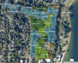
Cool GIS Map of our Park
The Green Seattle Partnership has worked to track restoration all over Seattle. This is encapsulated in an online map, where you can search for a park (like Madrona Park, or Lakeridge Park), or just zoom and browse. You can click on ecological regions within a park, and find all kinds of data like acreage, phase (restoration progrees), target forest type (plant ecosystem), and steepness of slope. Believe me, the steepness matters. Click here for the city-wide map. A version of the map of Madrona Woods is below.


